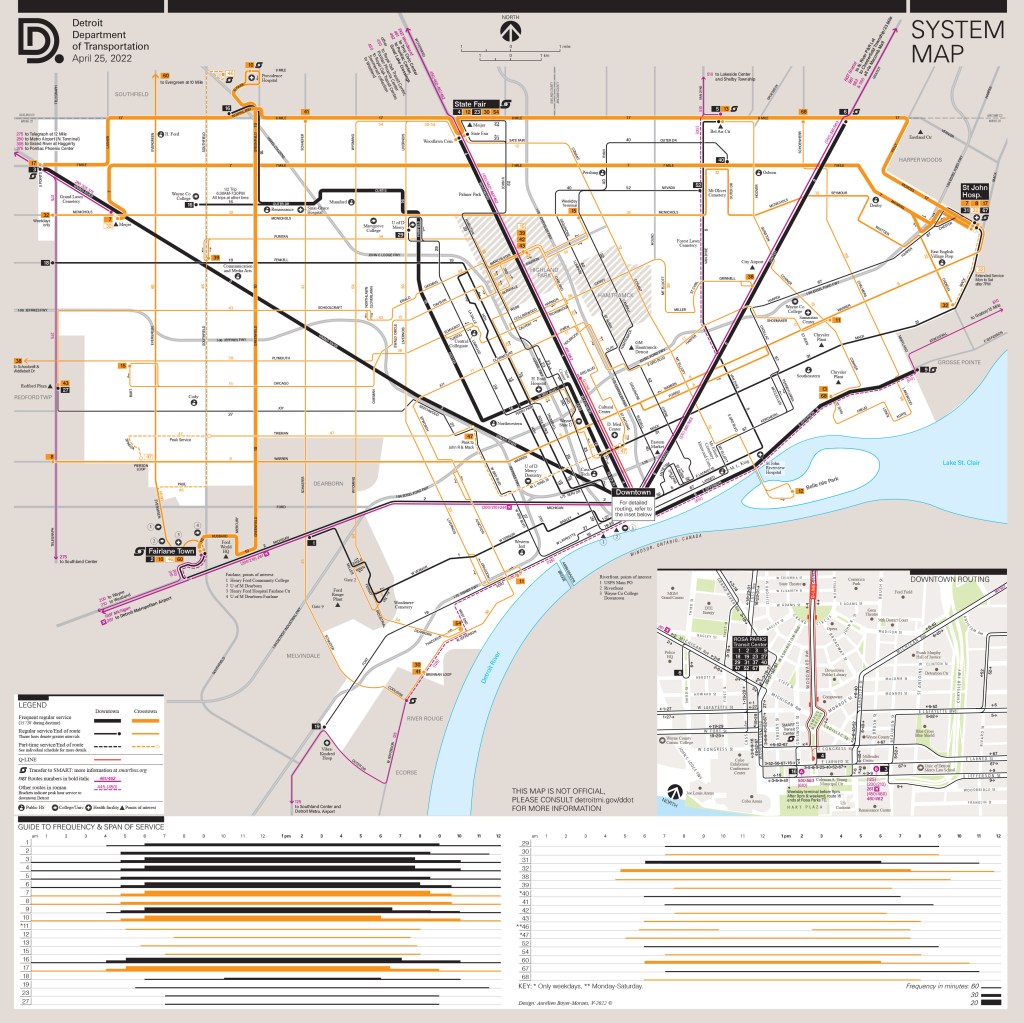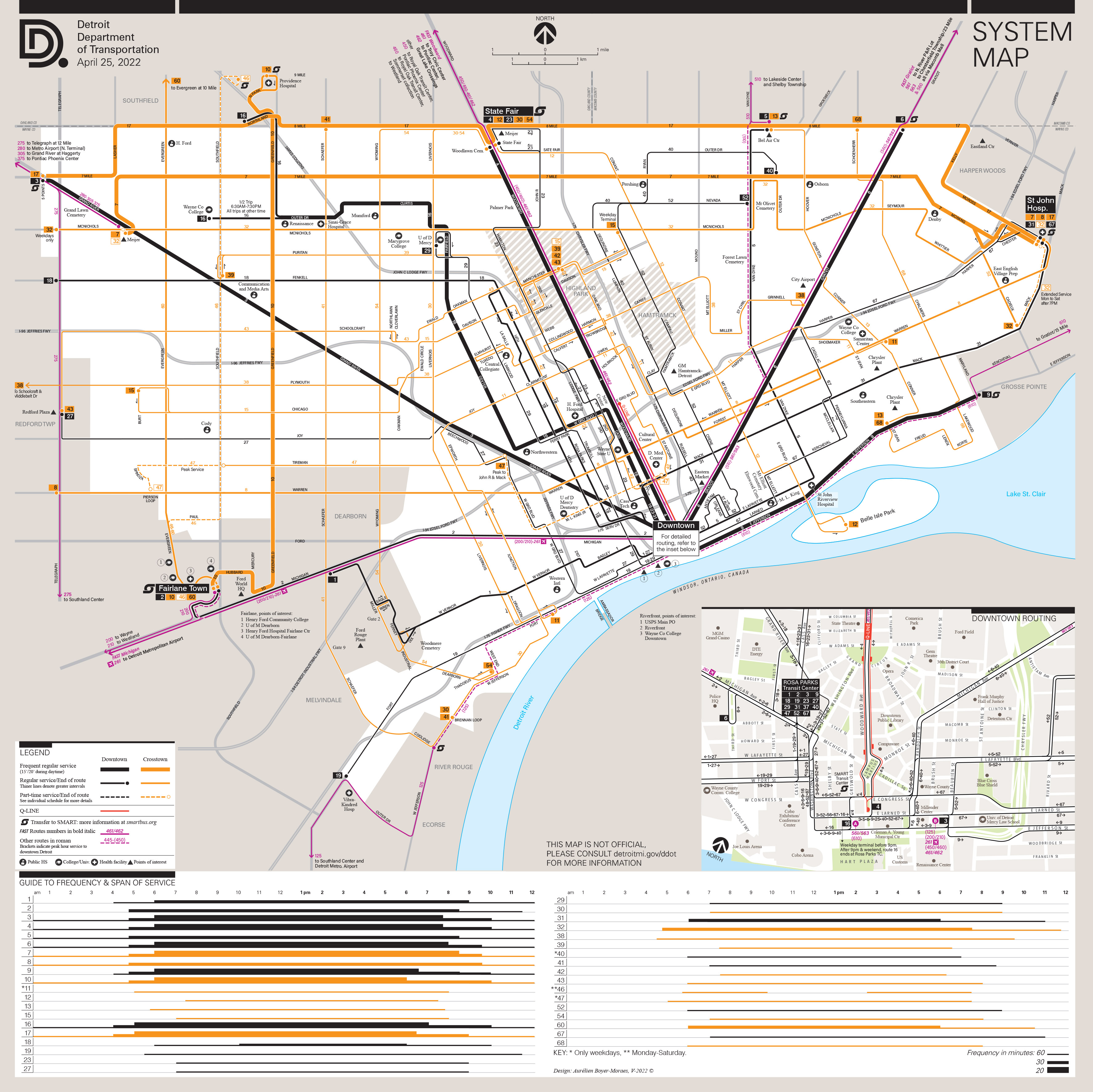
Updating and more.

With the return of a level of service to near pre-pandemic, I updated the whole Detroit public transportation information guide-map.
The restauration of some routes which were suspended and the return of owl service on nine routes before, made me rethink the whole document.
Besides a reorganisation of the legend and other information pertaining to the offer depicted, one of the main difference with my previous versions is the return of a guide to frequency. This guide, placed below the map, is renewed and simplified “to the bones”.
Perpendicular to the route numbers placed in ordinate, the intervals are translated into thicknesses in abscissa along the 24 hours of the day, toward the right, rendering visible for any given route its span of service and frequency. The same color code is used as in the map, as well as for the thickness of route lines. It is a sort of outcome of the map, a logical “consequence”, the two resonate.
Below, the whole document (it became a square).