My latest map, on an idea which was running through my mind for a while. Just in time for the…
")
Aurélien Boyer-Moraes is a graphic designer focused on cartographic and information design.
My latest map, on an idea which was running through my mind for a while. Just in time for the…

Carte des lignes ferroviaires et routières du réseau voyageurs, service hiver 1990. J’ai trouvé il y a peu un «…

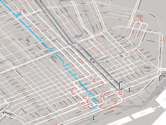
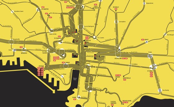
As I like to depict the flow of the different routes within this type of urban grid, here is the…

J’ai trouvé, il y a peu, un plan du réseau des transports publics de Marseille, de la C.G.F.T. (Compagnie Générale…
Une fois n’est pas coutume, le plan que je présente est un brouillon, de 73 × 42 cm (l.×H.), fait…
Buenos Aires Streetcar Map: a revisitation of my first interpretation of the Di Paolo-Pares small map of the central area…
An iconic transport diagram revisited. This route diagram of the Halifax Transit network is based on the map conceived by…
A new “plan-témoin”.
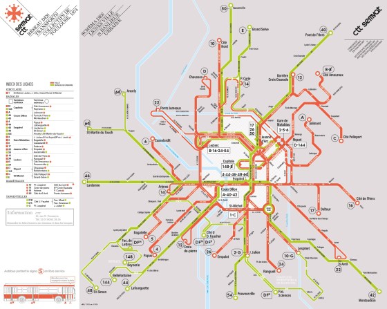
Un nouveau «plan-témoin» d’un réseau à une époque, à Toulouse, en 1974.
Construction de deux plans du réseau de la RATVM (Régie Autonome des Transports de la Ville de Marseille) tel qu’il…

Apropos my very recent discovery of a sketch of the public transit map of Toulouse from the late 1960s (or…

A new attempt at depicting the current public transport network of Lisbon and immediate surrounding communities. (right-click on the map…

An insight through maps (Right-click to open in a new tab to see full size) A representation through time of…
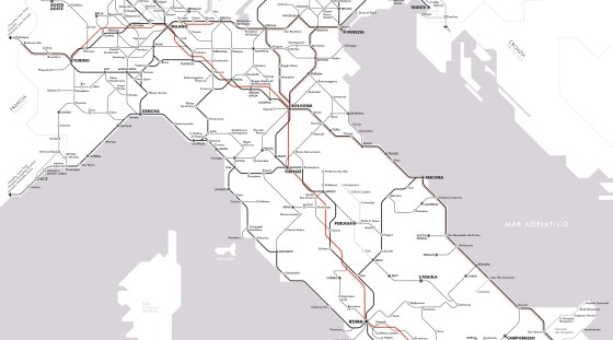
Il y a un peu plus d’un an, j’ai publié une carte du réseau voyageurs de la SNCF en hommage…
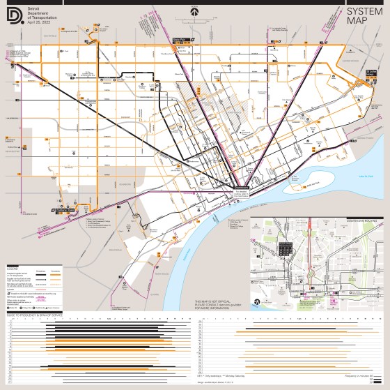
Updating and more. With the return of a level of service to near pre-pandemic, I updated the whole Detroit public…
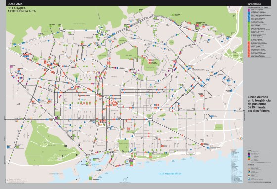
Two solutions, toward a schematic high frequency map. Here go the fruits of my latest and longest work in years:…

DDoT System Map (unofficial) updated It was a long time since the last update, since significant steps had been made…

Update (about the fate of this map)
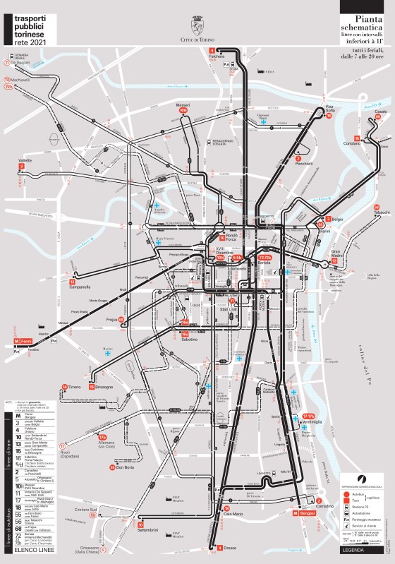
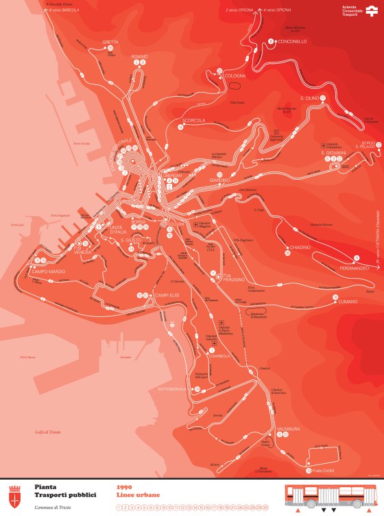
Here goes my last transit mapping project. A high frequency map of the public transport system of Turin, explicitly entitled:…

Detroit Transit Map

Plan du réseau de métro, tramways, funiculaires et lignes labellisées C dites « fortes », du réseau de transports en commun de l’agglomération lyonnaise (TCL).
Version produite et livrée en mai 2011 à l’agence Attoma, pour le SYTRAL.
