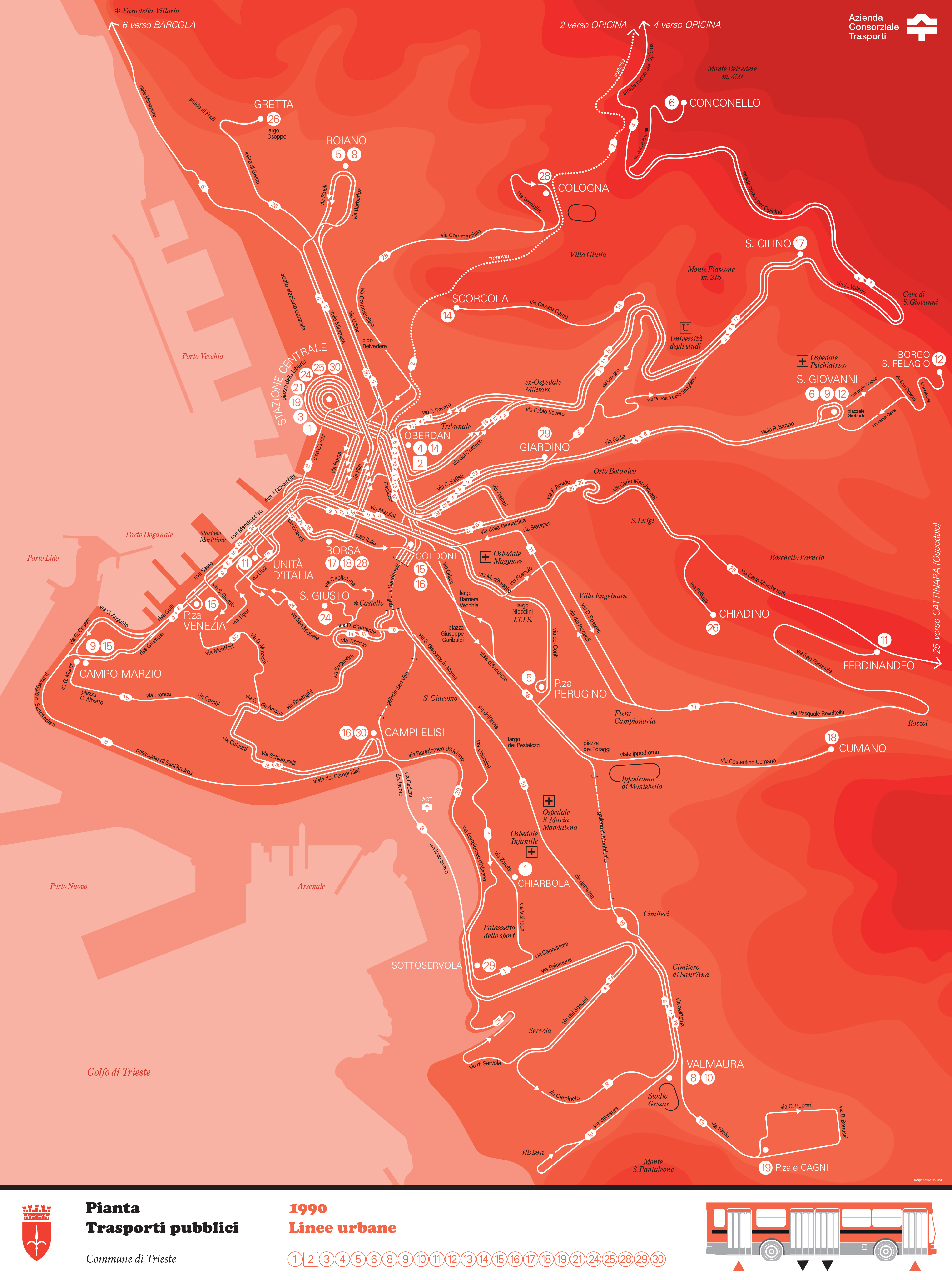
A new “plan-témoin”.
Here goes my latest plan-témoin of the urban* network of the public transport of the city of Trieste (Azienda Consorziale Trasporti) in 1990.
As for the other maps of this serie, it is mainly focused on the depiction of routes, no other elements of the urban fabric are drawn, there is no background in that sense (such as for the map of Marseille, cf. https://wordpress.com/post/transit-map.com/1040).
The design of the routes only, their winding paths through the territory of the city, as well as the contours of the elevation, the delination of the bay and the area of the port, show or invite to imagine this urban landscape.
It is more of a portrait, at a moment in time, than a traditional “transport map”.
Right-click and open in a new tab to see full-size.
* There is a distinction in this network, reflected in the tarification, between the urban and suburban routes. Here, only the main urban routes are depicted (numbers 1 to 30).
