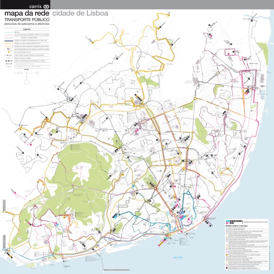
A new attempt at depicting the current public transport network of Lisbon and immediate surrounding communities. (right-click on the map … More

Aurélien Boyer-Moraes is a graphic designer focused on cartographic and information design.
A new attempt at depicting the current public transport network of Lisbon and immediate surrounding communities. (right-click on the map … More

An insight through maps (Right-click to open in a new tab to see full size) A representation through time of … More
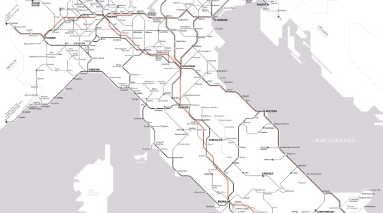
Il y a un peu plus d’un an, j’ai publié une carte du réseau voyageurs de la SNCF en hommage … More
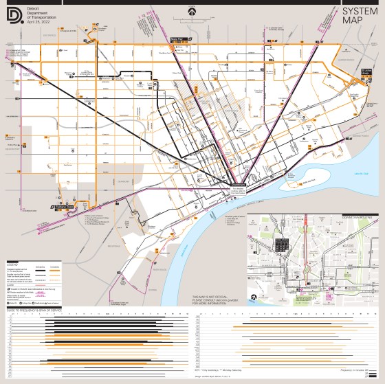
Updating and more. With the return of a level of service to near pre-pandemic, I updated the whole Detroit public … More

I was invited to submit a poster for the 3rd Schematic Workshop 2022, which was held last week (April 21-22) … More
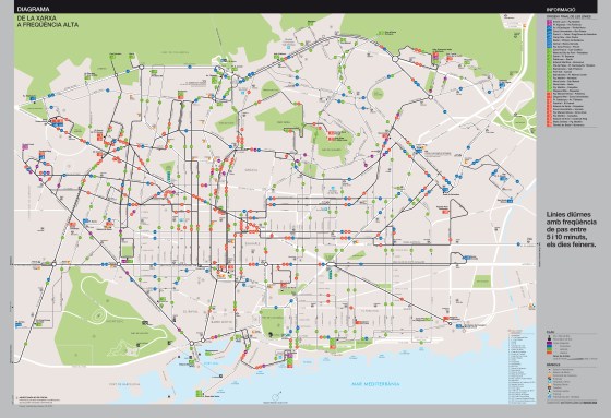
Two solutions, toward a schematic high frequency map. Here go the fruits of my latest and longest work in years: … More

DDoT System Map (unofficial) updated It was a long time since the last update, since significant steps had been made … More

Update (about the fate of this map)
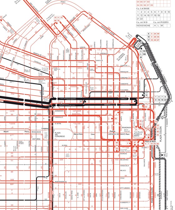
I discovered some time ago an old and outstanding map of streetcar routes of the city of Buenos Aires. This … More
Further about this network map (specially in comparison to the former attempt and different approach displayed on this site, cf … More
