
Apropos my very recent discovery of a sketch of the public transit map of Toulouse from the late 1960s (or early 1970s), I want to share a map of mine of the Toulouse network from almost half a century later, that is 2013, which was for years in reserve and sidelined (or so I thought until lately*).
Here goes the latest draft of the work I’ve done between late June and early October 2013 , tasked by Attoma, for the public transit system of Toulouse, the fourth French urban area.
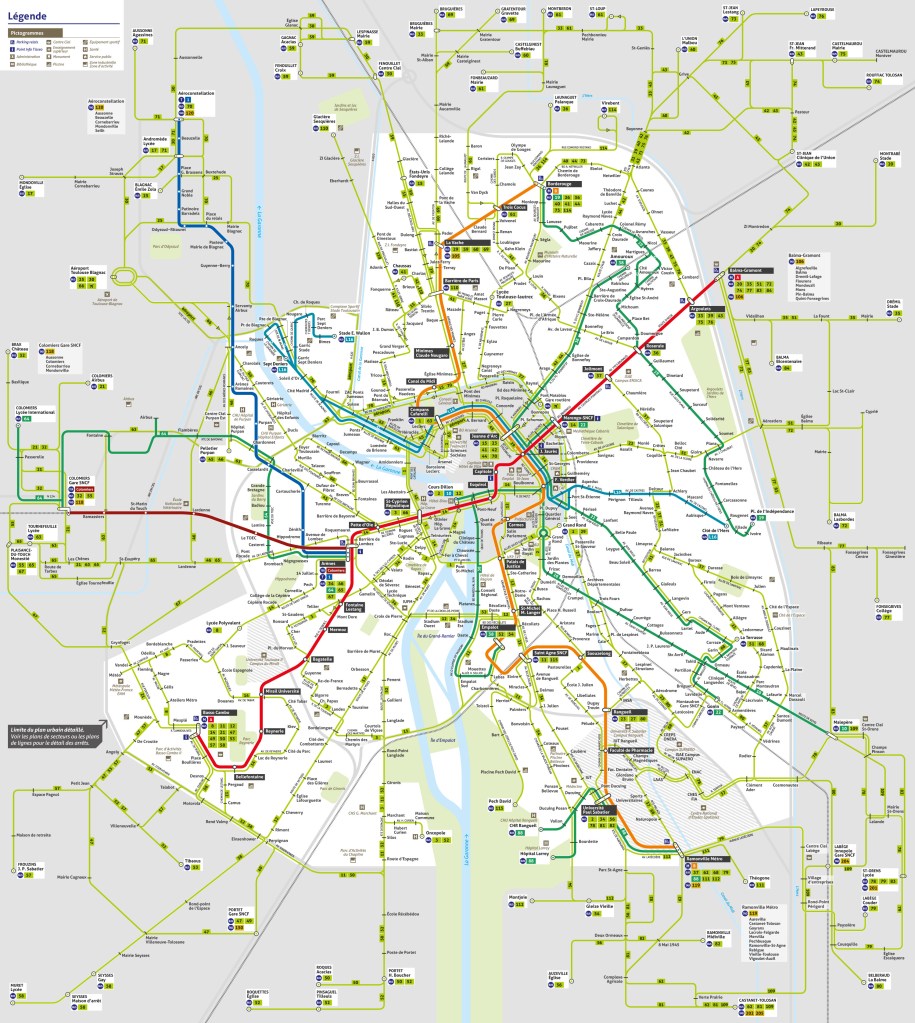
The relatedness between my map ― I call it “géo-schématique” in French ― and the current “plan général” is obvious because my map has been revised and updated in-house by Tisseo (commercial name of the network) since September 2016**, the first time the network decided to implement it, three years after I sent my latest draft. This “plan général” is displayed at every bus stop equipped (nearly 3000) and available in pdf online, but not issued in printed form to the customers (a totally different map is issued as a pocket map).
Since this nearly ten year old work of mine has finally reached the public under a somewhat different form… I wanted to present the original one. Here it is {right-click to open in a new tab to see full size}.
- * I only discovered that my latest draft was eventually used by this network while reviewing online the “state of the art” of public transport maps, in 2021. Until then I thought it was abandoned and forgotten.
- ** Its release was announced in an article of a local newspaper, “La Dépêche”, published when the new map, contrasting sharply with its late predecessor, was implemented throughout the city. I also discovered this article after I found out my map (then updated and changed in other aspects, such as colors) was used, while doing some research to understand better what had happened.
