São Paulo is quite the climatic (proto-)subtropical megacity of 11.4 millions inhabitants within its city limits only, whereas its conurbation has now for a long time surpassed the 20 million cap.
Anyway, I said that São Paulo is quite special in its peculiar way of being a proto-subtropical city. I won’t enter here in climatic definition by its diverse variables known and registered but the sky is frequently overcast and turbulent. Also the fact that the city is quite high in altitude has an impact on its tempratures (cool for the latitude) because it is between 760 metres at min., and at max. 1,135 metres above the sea level.
This city is intriguing in so many ways I will only focus on one, yet not small, common on this site: its surface public transit system, and more specifically its bus and trolleybus lines, since this latter mode, not really in fashion in western Europe, despite the fact it has more than proved its resilience, its maturity in so many networks, in so many latitudes and longitudes, circumstances, situations…
The latest version (the In Motion Charging Trolleybus), a vehicle that can reload its embarked small batteries while circulating, rend its numerous advantages to a higher level, and can even remove on several parts the double overhead wires, that could be so problematic to some.
So here we are, in the southern part of the extremely vast Brasil, not that far away from Rio de Janeiro, but in a completely different context, geographically, urbanistically, to sum up idiosincrasically (if I may).
I spent some time exploring the “sptrans” website. I learnt to decrypt the digits and letters that compose the routes’ identifications.
I have a lot of respect for the people* who came up with this idea and managed to implement it, in 1976.
It is efficient, because in a city of this size and population, you cannot count on your sequential 1 to 99 or worse 1 to 999, you must go beyond that, in order to make sense of it (it works both way, a good “nomenclature” can help to think better the network).
These identifications come in two blocks, the first is formed of four digits, or three digit and a letter; the second separed from the first by an hyphen is formed of two digits.
- The first digit indicates the region (the city has been divised in 9 areas) of origin,
- the second indicates differents things : 0, that line goes through the city center ; 1 to 6 the line goes through other areas; 7 indicates the line mainly serves a metro station.
- The third digit indicates the destination area in the same manner the first does;
- the double noughts indicate great radials which use thoroughfares from the city center.
- If after the three first digits there is a letter, it indicates that several lines have the same origin and are going through the same path, this last letter is here to differentiate them, they are assigned alphabetically.
- Finally, after the hyphen, the two digits:
10, means that this is the a regular diurn service (remember this becasue it is the only lines I took into account for my map);11indicates the night service ;- 21 to 29 indicate partial routes for peak hour requirements;
- then 31 to 59, are for every kind of diverging you can imagine, forking, extension of the main regular service.
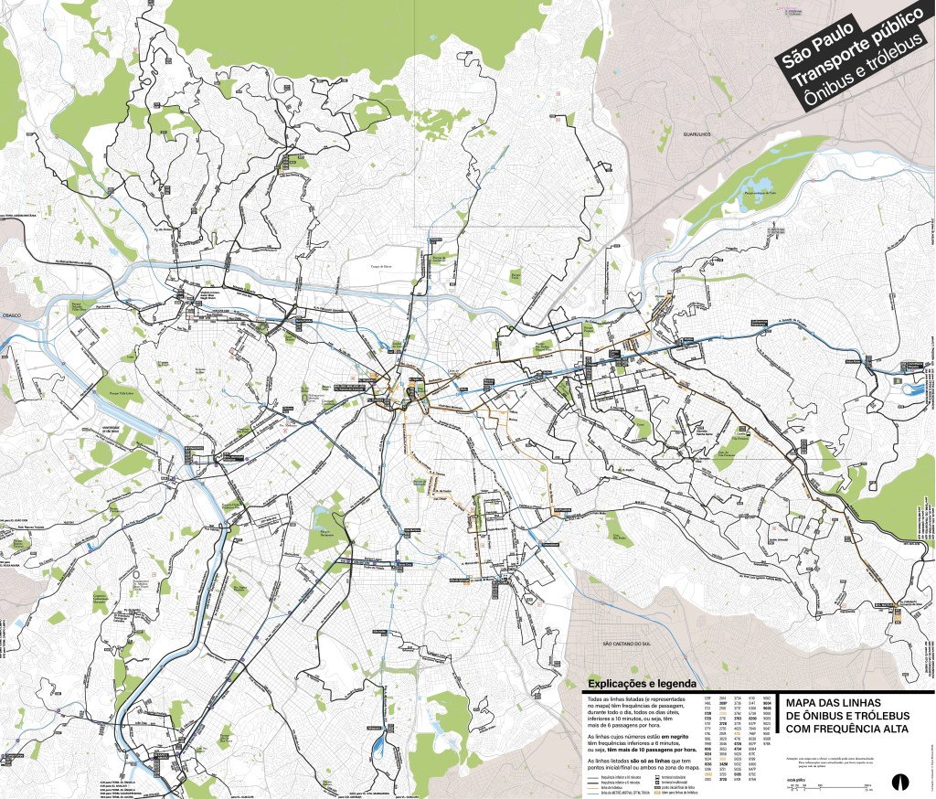
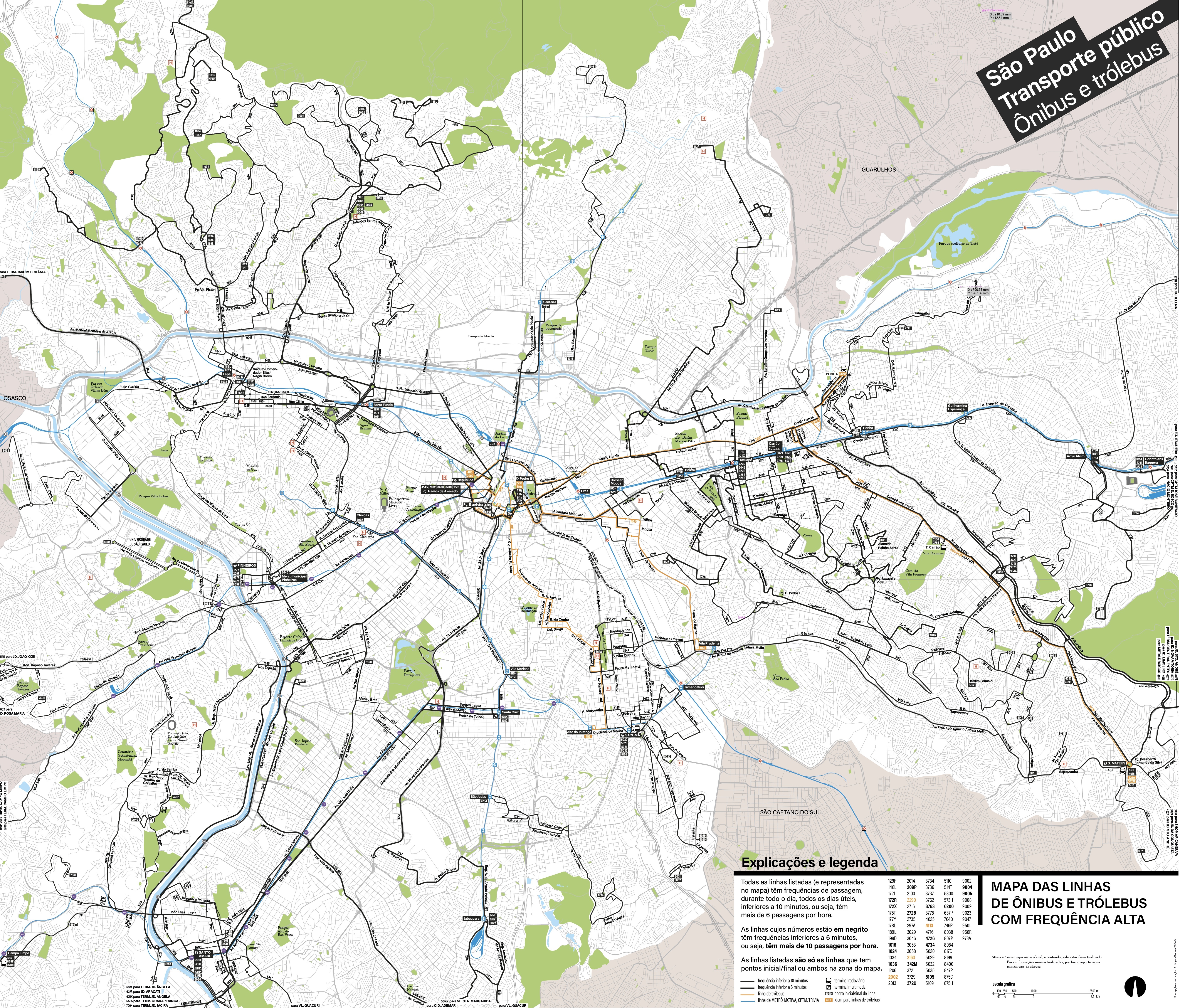
I took into account not only the regular-type services (DDDD-10 or DDDL-10), but also, and that is the point of the map, the most frequent lines, that have a start or an end in the city as I represented it, quite a chunk of it actually.
So, you have the lines which run at 10 minutes minimum all-day, and the lines which run at 6 minimum all-day. Many of the six minutes-minimum lines have peak frequency of 3-4 minutes, and many 10 minutes-minimum have peak service of 7-9 minutes.
They are differentiated by, and only by, the width of their black line depiction on the map, which background I put into a low grey, and natural (equivalent colour) for water and green spaces, because if I am called a functionnalist, or even a sorta frustrated functionnalist, I know when something wouldn’t make sense in the context, so the only other colour that is used is this orange. This orange offers an excellent contrast with the black (at least the very dark grey that I use for “black”) as well as with the blue.
This trolleybus system is reduced to a handful lines, that still show the remains of a solid structure with regards to the city and general network, even its former paths of expansion.
I obviously couldn’t do, even for a “partial map of the public transit of São Paulo”, without taking in account in some extent the metro or subway.
The Metrô system which is well developped compared to the one of Rio (even if the city is smaller, the metro here is embryonic). In São Paulo it is divided in a handfull companies. I love to keep it simple on the map, this is not a metro map after all, so every line is the same colour, blue, then only their stations show the company to whom they belong.
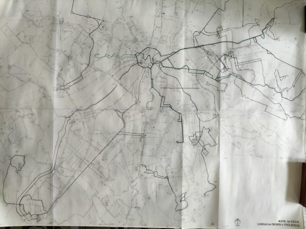
I show an image (in JPG) of the whole as usual for obvious reason, this is internet. This map, entirely vectorial, took some time to do, and only for the second time, I will show the first draft, drawn on paper, at 1:20,000 scale, while I was perusing the “sptrans” site to go through every individual line (in order to get their span of service, their base and peak hour frequencies).
Nonetheless they are 78 individial lines depicted on the vecrorial map, but I had to get through a total of 166 (that can be found on the draft, and paint another city, I should start a game).
I have to say the only other time I presented a draft here, the same kind, « crayon & papier calque » (lead pencil and tracing paper), it was for Montevideo’s network, yet in that case I never achieved any kind of satisfactory map. It does not mean I intend to drop it.
The only thing I droped is the suffix “-10” for the lines identification, since it is the map of the regular lines with very high frequencies.
I hope you enjoy escpaping through this maze, it was a thrilling pleasure drawing it.
A. B.-M., 5 October 2026
* Cauduro Associados led by João Carlos Cauduro, with Adriano Murgel Branco