Skip to content

City & Transit Maps

  • Analysis/On Maps…
  • Quick bio
  • Une rapide bio
  • More about Transit Maps
  • WordPress.com

Aurélien Boyer-Moraes is a graphic designer hailing from France, specialised in cartographic and information design.

  • Home
  • About
  • Transit Maps
  • City Maps
  • Villes Bis
  • Contact

Tag: GraphicDesign

Circulação (Lx)

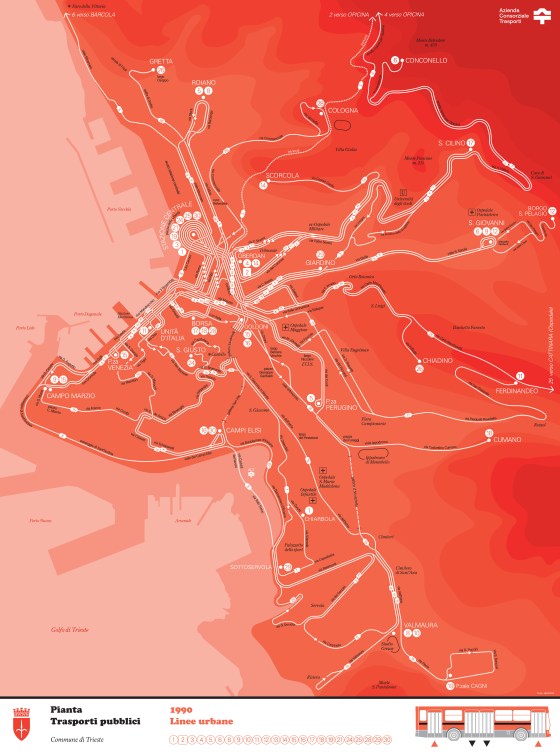
My latest map, on an idea which was running through my mind for a while. Just in time for the … More

Cartography, GraphicDesign, Lisbon, Map

Cincinnati Downtown Bus Map 1977

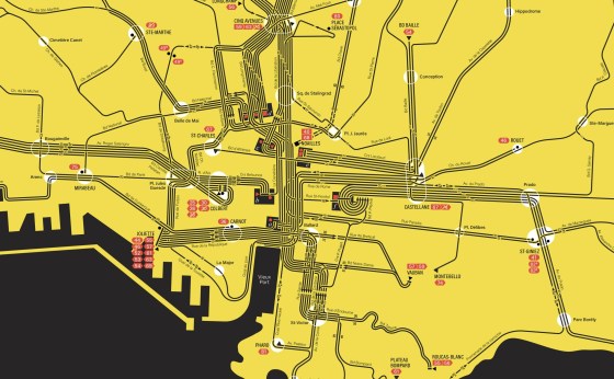
As I like to depict the flow of the different routes within this type of urban grid, here is the … More

Cincinnati, GraphicDesign, PublicTransit, TransitMap

Halifax Diagram revisited, 1978

An iconic transport diagram revisited. This route diagram of the Halifax Transit network is based on the map conceived by … More

Cartography, GraphicDesign, GraphicHistoiry, Halifax, NetworkMap, Nova Scotia, PublicTransit, TransitMap

Map of Trieste Public Transport, 1990

A new “plan-témoin”.

Cartography, Design, GraphicDesign, Italy, NetworkMap, PublicTransit, TransitMap, Trieste

Marseille, réseau de la RATVM en 1957

Construction de deux plans du réseau de la RATVM (Régie Autonome des Transports de la Ville de Marseille) tel qu’il … More

Cartography, GraphicDesign, Marseille, NetworkMap, PublicTransit, RATVM, RTM, SystemMap, TransitMap

Toulouse public transport draft from Autumn 2013

Apropos my very recent discovery of a sketch of the public transit map of Toulouse from the late 1960s (or … More

Cartography, GraphicDesign, NetworkMap, PublicTransit, Toulouse, TransitMap

Lisbon Carris Map, Winter 2022-2023

A new attempt at depicting the current public transport network of Lisbon and immediate surrounding communities. (right-click on the map … More

Carris, Cartography, GraphicDesign, Lisboa, Lisbon, Map, NetworkMap, PublicTransit, TransitMap

Lisbon streetcar network, 1964-today

An insight through maps (Right-click to open in a new tab to see full size) A representation through time of … More

Carris, Cartography, GraphicDesign, Lisboa, Lisbon, Lisbonne, Map, NetworkMap, PublicTransit, Streetcar, TransitMap

Carte du réseau ferré italien

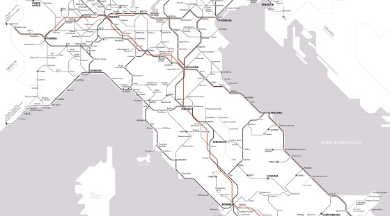
Il y a un peu plus d’un an, j’ai publié une carte du réseau voyageurs de la SNCF en hommage … More

Cartography, GraphicDesign, InformationDesign, Italy, NetworkMap, Train, TransitMap

Detroit 2022 Transportation Guide

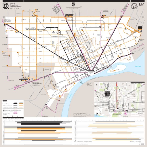
Updating and more. With the return of a level of service to near pre-pandemic, I updated the whole Detroit public … More

Cartography, Detroit, Diagram, GraphicDesign, Infographics, InformationDesign, NetworkMap, TransitMap

Posts navigation

Older posts

  • cityandtransitmaps's avatar cityandtransitmaps
Blog at WordPress.com.
  • Subscribe Subscribed
    • City & Transit Maps
    • Already have a WordPress.com account? Log in now.
    • City & Transit Maps
    • Subscribe Subscribed
    • Sign up
    • Log in
    • Report this content
    • View site in Reader
    • Manage subscriptions
    • Collapse this bar
 

Loading Comments...