Skip to content

City & Transit Maps

  • Analysis/On Maps…
  • Quick bio
  • Une rapide bio
  • WordPress.com
  • More about Transit Maps

Aurélien Boyer-Moraes is a graphic designer hailing from France, specialised in cartographic and information design.

  • Home
  • About
  • Transit Maps
  • City Maps
  • Villes Bis
  • Contact

Tag: NetworkMap

1938, les plans de réseaux de Marseille et Londres : plus qu’un air de famille.

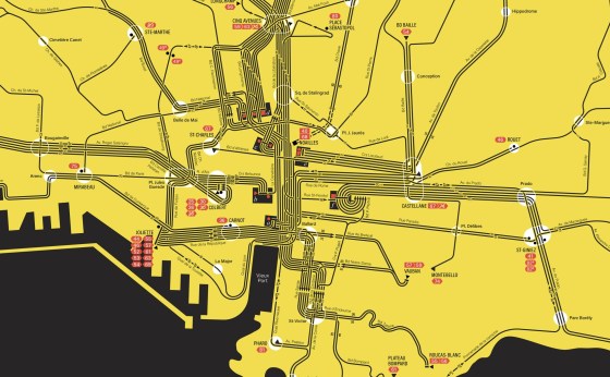
J’ai trouvé, il y a peu, un plan du réseau des transports publics de Marseille, de la C.G.F.T. (Compagnie Générale … More

Cartography, London, Map, Marseille, NetworkMap, TransitMap

Buenos Aires Streetcar Map, suite

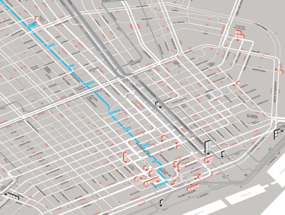
Buenos Aires Streetcar Map: a revisitation of my first interpretation of the Di Paolo-Pares small map of the central area … More

BuenosAires, Cartography, NetworkMap, PublicTransit, Streetcar, TransitMap

Halifax Diagram revisited, 1978

An iconic transport diagram revisited. This route diagram of the Halifax Transit network is based on the map conceived by … More

Cartography, GraphicDesign, GraphicHistoiry, Halifax, NetworkMap, Nova Scotia, PublicTransit, TransitMap

Map of Trieste Public Transport, 1990

A new “plan-témoin”.

Cartography, Design, GraphicDesign, Italy, NetworkMap, PublicTransit, TransitMap, Trieste

Marseille, réseau de la RATVM en 1957

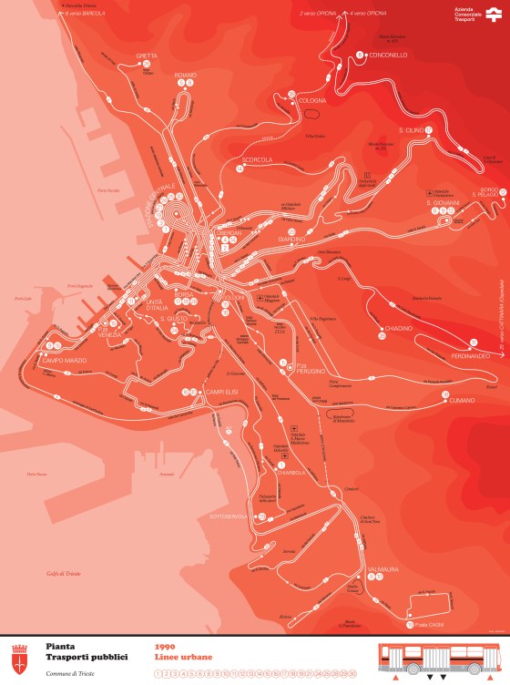
Construction de deux plans du réseau de la RATVM (Régie Autonome des Transports de la Ville de Marseille) tel qu’il … More

Cartography, GraphicDesign, Marseille, NetworkMap, PublicTransit, RATVM, RTM, SystemMap, TransitMap

Toulouse public transport draft from Autumn 2013

Apropos my very recent discovery of a sketch of the public transit map of Toulouse from the late 1960s (or … More

Cartography, GraphicDesign, NetworkMap, PublicTransit, Toulouse, TransitMap

Lisbon Carris Map, Winter 2022-2023

A new attempt at depicting the current public transport network of Lisbon and immediate surrounding communities. (right-click on the map … More

Carris, Cartography, GraphicDesign, Lisboa, Lisbon, Map, NetworkMap, PublicTransit, TransitMap

Lisbon streetcar network, 1964-today

An insight through maps (Right-click to open in a new tab to see full size) A representation through time of … More

Carris, Cartography, GraphicDesign, Lisboa, Lisbon, Lisbonne, Map, NetworkMap, PublicTransit, Streetcar, TransitMap

Carte du réseau ferré italien

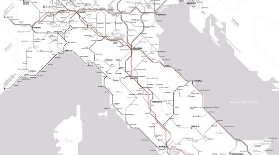
Il y a un peu plus d’un an, j’ai publié une carte du réseau voyageurs de la SNCF en hommage … More

Cartography, GraphicDesign, InformationDesign, Italy, NetworkMap, Train, TransitMap

Detroit 2022 Transportation Guide

Updating and more. With the return of a level of service to near pre-pandemic, I updated the whole Detroit public … More

Cartography, Detroit, Diagram, GraphicDesign, Infographics, InformationDesign, NetworkMap, TransitMap

Posts navigation

Older posts

  • cityandtransitmaps's avatar cityandtransitmaps
Blog at WordPress.com.
  • Subscribe Subscribed
    • City & Transit Maps
    • Already have a WordPress.com account? Log in now.
    • City & Transit Maps
    • Subscribe Subscribed
    • Sign up
    • Log in
    • Report this content
    • View site in Reader
    • Manage subscriptions
    • Collapse this bar
 

Loading Comments...